


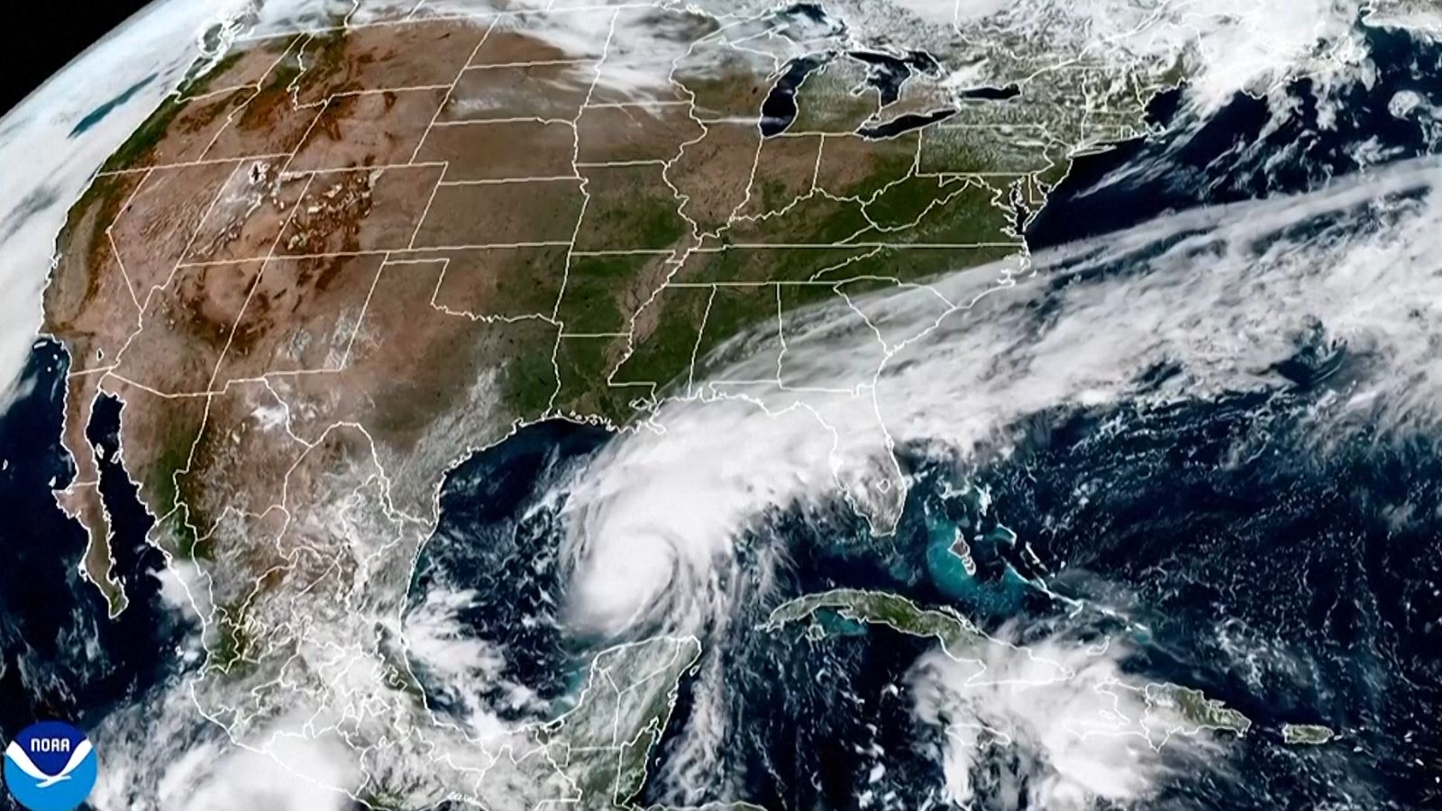


United States: Hurricane Isaias strengthened on Thursday as it moved towards the US Gulf Coast, prompting mandatory evacuations in parts of Florida and emergency declarations in Alabama. Forecasters warned of life-threatening storm surges, tornadoes, and flooding.
The first Atlantic hurricane of the 2026 season had maximum sustained winds of 85 mph early on Thursday, according to the US National Hurricane Center (NHC). Isaias was forecast to approach Category 3 intensity, with sustained winds reaching 110 mph on Friday before reaching the northern Gulf Coast late Friday or early Saturday.
“Our assumption is that it's going to hit strong as a probably lower Category 3,” Florida Governor Ron DeSantis said at a briefing on storm preparations in Tallahassee.
Hurricane warnings extended from coastal Mississippi through Alabama to the Florida Panhandle, while tropical-storm and storm-surge warnings covered parts of southeastern Louisiana, the NHC said.
Isaias was forecast to reach sustained winds of around 110 mph (175 kph) early on Friday before weakening somewhat as it approached land. Increasing vertical wind shear, which can disrupt a hurricane’s circulation, was expected to limit its strength near landfall. Forecasters nevertheless warned that the storm would remain dangerous.
The hurricane has already disrupted oil and gas production in the Gulf of Mexico, forcing energy companies to evacuate offshore platforms and suspend operations.
Isaias came close to matching the record for the latest first Atlantic hurricane of a season, previously set by a storm that struck on October 8, 1905.
The strong El Niño weather pattern this year has suppressed Atlantic hurricane development by increasing vertical wind shear, which disrupts the formation and intensification of tropical storms.