



The world may soon look different, at least on the maps we use every day. The United Nations General Assembly has backed a resolution calling for a shift away from the centuries-old Mercator projection towards maps that represent the relative size of continents more accurately, particularly Africa.
The 'Correct the Map' resolution, led by Togo and backed by the African Union (AU), passed with 164 votes in favour. The United States was the only country to vote against it, while six countries abstained.
But this does not mean the Mercator map is about to disappear. The UN resolution is not legally binding. Instead, it encourages governments, educational institutions, and technology companies to consider projections that more accurately represent the world's landmasses.
So, why has a map become the subject of an international debate?
What is the Mercator map?
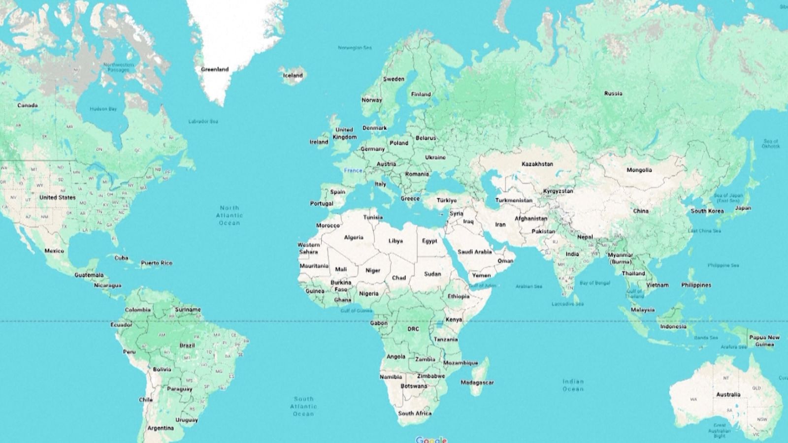
The Mercator projection was created in 1569 by Flemish cartographer Gerardus Mercator.
It was designed mainly for navigation because it allows sailors to plot routes using straight lines. To keep compass angles accurate on a flat map, Mercator gradually stretched the grid lines as they moved farther from the Equator.
But this created a major problem: the size of landmasses became increasingly distorted the farther they were from the Equator.
Areas near the poles appear much larger than they are, while regions around the Equator appear comparatively smaller.
Why has the Mercator map become controversial?
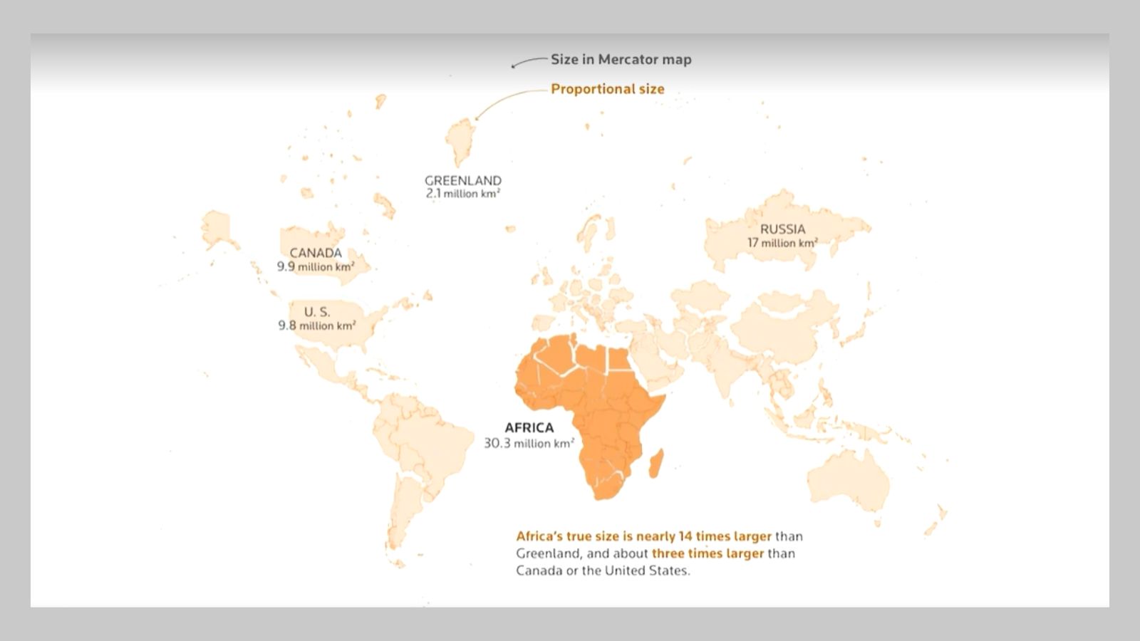
On a standard Mercator map, Greenland can appear similar in size to Africa. But Africa covers about 30.3 million square kilometres, while Greenland is around 2.16 million square kilometres.
That means Africa is roughly 14 times larger than Greenland.
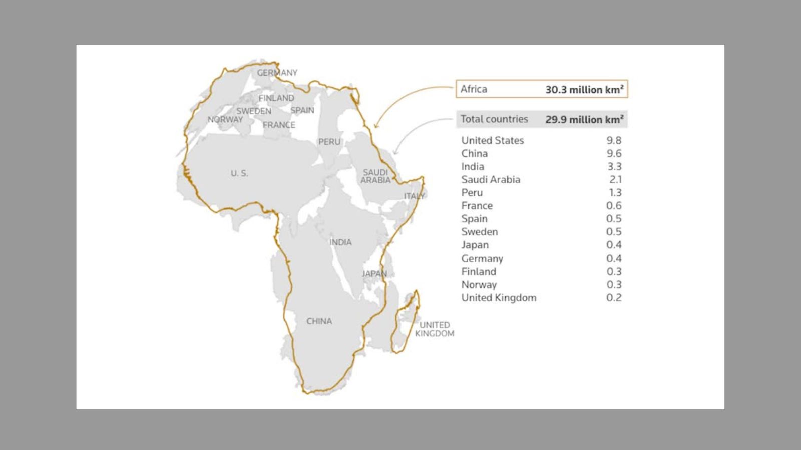
Africa's size can also be difficult to appreciate when viewed on conventional world maps. The continent is large enough to contain the land areas of the United States, China, India, Japan, Mexico and much of Europe combined.
The controversy is not only about geography. Historians and geographers have argued for years that the Mercator projection is rooted in Western stereotypes. Activists have also used the term “cartographic colonialism” while criticising the way the map represents different regions.
The concern was that a projection that makes Africa and other regions near the Equator appear smaller can influence how people perceive the relative size and importance of different parts of the world.
Why is the Equal Earth map being favoured over the Mercator map?
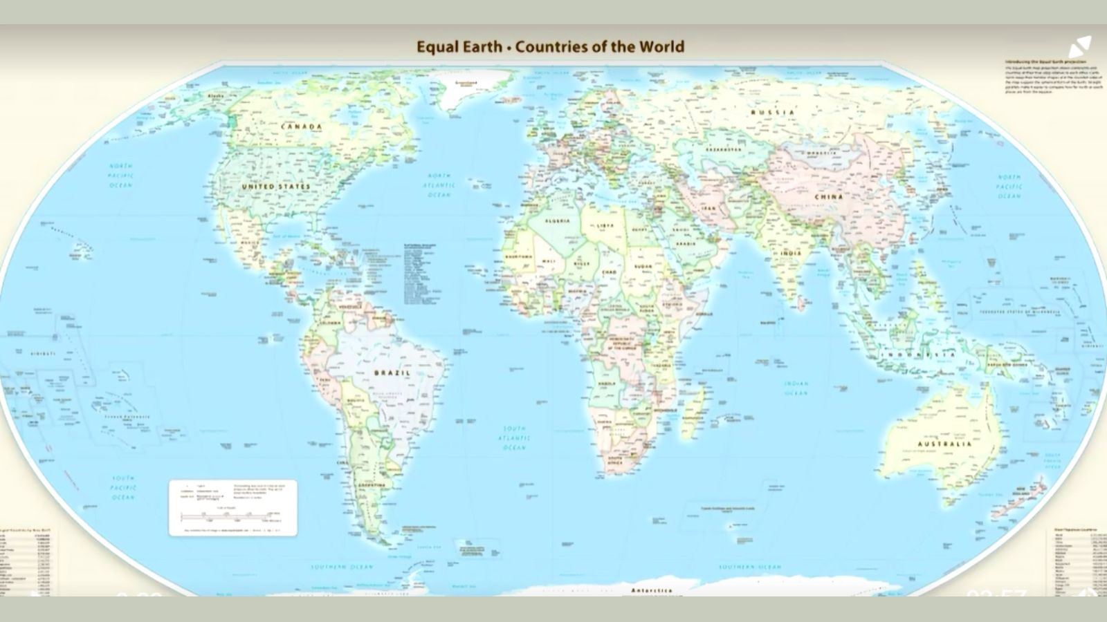
The Equal Earth projection was developed by a team of cartographers in 2018, with the aim of showing the relative size of landmasses more accurately.
When the two maps are compared, the difference is clear. Africa appears much larger on Equal Earth. Europe becomes smaller, Brazil appears larger and Greenland is dramatically reduced in size.
The projection therefore gives a visual representation that is closer to the actual proportions of the world's landmasses.
The AU members adopted the Equal Earth map in February, before the United Nations resolution.
Togo then led the initiative on behalf of the African Union campaign to limit the use of the Mercator map, which was created more than 450 years ago for navigation.
Also Read:
Is Equal Earth a perfect map?
There is no single perfect world map because the Earth is round while a map is flat. Every projection involves some compromise.
Equal Earth gives up some of the features that made Mercator useful for navigation. Straight lines on Earth do not work in the same way on Equal Earth, and it cannot perfectly measure the true distance between different places.
Even though UN has passed the resolution, they are non-enforceable. Countries and institutions will therefore not be required to use only the new projection, nor will they be prohibited from using the Mercator map.
The resolution is instead part of a push towards maps that present the relative size of regions more accurately.
Why did the US vote against it?
Voting against, the United States argued that the resolution was not simply about updating cartographic proportions, but was connected to what it described as a broader ideological project.
“Instead of focusing on genuine problems of international peace, prosperity, or good relations, this body is debating map projects from the 16th century and their role in promoting reparations and “cognitive justice.” Resolutions like this and the ideological agenda they promote are barnacles on our work here, and the reason this institution is losing its credibility. When the United Nations questions why it is losing legitimacy in the world and is not taken seriously, time and again, we point to resolutions such as this,” it said.